
Jackson, California
Jackson | |
|---|---|
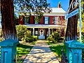
 Historic downtown Jackson | |
 Flag | |
| Motto(s): "Preserving our past, enriching our present, building our future" | |
 Location of Jackson in Amador County, California. | |
 Jackson Location in California  Jackson Jackson (the United States) | |
| Coordinates: 38°20′56″N 120°46′27″W / 38.34889°N 120.77417°W | |
| Country | |
| State | |
| County | Amador |
| Settled | 1848 |
| County Seat, Amador County | 1854 |
| Incorporated | December 5, 1905[1] |
| Government | |
| • Mayor | Steve McLean[2] |
| • Vice Mayor | Chad Simmons[2] |
| • State Senate | Angelique Ashby (D)[3] |
| • State Assembly | Joe Patterson (R)[4] |
| • U. S. Congress | Tom McClintock (R)[5] |
| Area | |
• Total | 3.58 sq mi (9.27 km2) |
| • Land | 3.58 sq mi (9.27 km2) |
| • Water | 0.00 sq mi (0.00 km2) 0% |
| Elevation | 1,217 ft (371 m) |
| Population | |
• Total | 5,019 |
| • Density | 1,400/sq mi (540/km2) |
| Time zone | UTC-8 (PST) |
| • Summer (DST) | UTC-7 (PDT) |
| ZIP code | 95642 |
| Area code | 209 |
| FIPS code | 06-36980 |
| GNIS feature IDs | 1658849, 2410128 |
| Website | ci |
| Reference no. | 118 |
Jackson (formerly, Botilleas, Botilleas Spring, Bottileas, Bottle Spring,[9] and Botellas)[10] is a city in and the county seat of Amador County, California. Its population was 5019 at the 2020 census, up from 4,651 at the 2010 census. The city is accessible by both State Route 49 and State Route 88.
Geography and geology
[edit]According to the United States Census Bureau, the city has a total area of 3.7 square miles (9.6 km2), all of it land. Jackson Creek traverses the city. Alluvial soils such as Pardee cobbly loam is found throughout the Jackson area.
Climate
[edit]According to the Köppen climate classification, Jackson has a hot-summer Mediterranean climate (abbreviated Csa).
| Climate data for Jackson, 1991–2020 simulated normals (1243 ft elevation) | |||||||||||||
|---|---|---|---|---|---|---|---|---|---|---|---|---|---|
| Month | Jan | Feb | Mar | Apr | May | Jun | Jul | Aug | Sep | Oct | Nov | Dec | Year |
| Mean daily maximum °F (°C) | 55.4 (13.0) |
58.6 (14.8) |
62.6 (17.0) |
67.1 (19.5) |
76.3 (24.6) |
86.4 (30.2) |
93.4 (34.1) |
91.9 (33.3) |
86.7 (30.4) |
76.6 (24.8) |
63.9 (17.7) |
55.2 (12.9) |
72.8 (22.7) |
| Daily mean °F (°C) | 46.4 (8.0) |
48.7 (9.3) |
52.0 (11.1) |
55.2 (12.9) |
62.6 (17.0) |
70.3 (21.3) |
76.6 (24.8) |
75.9 (24.4) |
71.6 (22.0) |
63.1 (17.3) |
52.9 (11.6) |
46.2 (7.9) |
60.1 (15.6) |
| Mean daily minimum °F (°C) | 37.2 (2.9) |
38.8 (3.8) |
41.4 (5.2) |
43.5 (6.4) |
48.7 (9.3) |
54.5 (12.5) |
59.9 (15.5) |
59.9 (15.5) |
56.7 (13.7) |
49.6 (9.8) |
42.1 (5.6) |
37.0 (2.8) |
47.4 (8.6) |
| Average precipitation inches (mm) | 5.54 (140.84) |
5.34 (135.71) |
4.86 (123.33) |
2.94 (74.72) |
1.60 (40.74) |
0.40 (10.21) |
0.02 (0.47) |
0.04 (0.95) |
0.22 (5.61) |
1.61 (40.88) |
3.00 (76.26) |
5.40 (137.19) |
30.97 (786.91) |
| Average dew point °F (°C) | 38.1 (3.4) |
39.0 (3.9) |
41.7 (5.4) |
43.0 (6.1) |
45.9 (7.7) |
47.8 (8.8) |
49.8 (9.9) |
48.2 (9.0) |
45.5 (7.5) |
41.9 (5.5) |
40.5 (4.7) |
37.4 (3.0) |
43.2 (6.2) |
| Source: PRISM Climate Group[11] | |||||||||||||
History
[edit]
Early history
[edit]The area was inhabited by the Northern Sierra Indians, who occupied areas along creeks, spring, and seep areas, including permanent and seasonal drainages, flat ridges, and terraces. Therefore, areas along watercourses are considered likely locations for prehistoric cultural resources. Permanent villages were usually placed on elevations above seasonal flood levels. Surrounding areas were used for hunting and seed, acorn, and grass gathering.
Recent history
[edit]Jackson, named after Colonel Alden Jackson, was founded in 1848 around a year-round spring. Settlement of the region by American pioneers was stimulated by the discovery of gold in the Sierra foothills around 1848. The settlement was named for a local lawyer who was liked by miners named Alden Appola Moore Jackson. Although Amador County was an important mining center, its county seat of Jackson was not typical of the early gold camps. The camp grew quickly, as besides being a popular mining spot, it was also a convenient stopping place on the road from Sacramento to the Southern Mines. The camp became an important supply and transportation center for the neighboring towns, and by 1850, its population had reached an estimated 1,500. Jackson grew first as a watering hole for cattle, then as one of the earliest and most durable of the mother lode's hard rock mining areas. In 1854, Jackson became the county seat of newly formed Amador County, California. Previously, from 1851 to 1852, it had been the county seat of Calaveras County.
Placer mining gave out by the 1860s, replaced by hard rock mining. One of the town's most prominent historical landmarks, the Kennedy Mine, began operation in 1860; at the time of its closure during World War II in 1942, it was the deepest gold mine in North America, at 1802 m (5912 ft). On August 27, 1922, 47 miners became trapped when a fire broke out in the Argonaut mine. All 47 men died in the fire, but the last body was not recovered until over a year later. The Argonaut mine incident was the worst gold mine disaster in US history.
In October 1942, the US government passed the War Production Board Limitation Order, which signaled the demise of gold mining in California. The government needed men for the war and gold was not considered a strategic war metal.
Landmarks
[edit]- Argonaut and Kennedy Mines: California Historical Landmark No. 786.[13]
- Jackson Gate: Jackson Gate, on the north fork of Jackson Creek, takes its name from a fissure in a reef of rock that crosses the creek. In 1850, about 500 miners worked here and the first mining ditch in the county was dug here; its water sold for $1 per inch, CHL No. 118.[14]
- Site of Jackson's Pioneer Jewish Synagogue: On September 18, 1857, Congregation B'nai Israel of Jackson dedicated on this site the first synagogue in the Mother Lode. High holy day worship continued until 1869 when the larger Masonic Hall was used to accommodate the congregation. The wooden structure then served as a schoolhouse until 1888. Relocated onto a nearby lot, it became a private dwelling, and was razed in 1948, CHL No. 865.[15] The Jackson Pioneer Jewish Cemetery (active from 1857 to 1921) was connected to the synagogue.
- Pioneer Hall: The Order of Native Daughters of the Golden West was organized on these premises, the site of the Pioneer Hall, on September 11, 1886, CHL No. 34.[16]
-
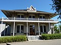 Amador County Hospital Building
 -

-
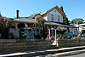 Grace Blair DePue House and Indian Museum
 -
 Kennedy Tailing Wheels Park
 -
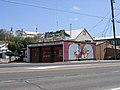 Historic Firehouse, Downtown
 -
 Memorial Clock
 -
 Amador County Museum


Demographics
[edit]| Census | Pop. | Note | %± |
|---|---|---|---|
| 1880 | 1,040 | — | |
| 1910 | 2,035 | — | |
| 1920 | 1,601 | −21.3% | |
| 1930 | 2,005 | 25.2% | |
| 1940 | 2,024 | 0.9% | |
| 1950 | 1,879 | −7.2% | |
| 1960 | 1,852 | −1.4% | |
| 1970 | 1,924 | 3.9% | |
| 1980 | 2,331 | 21.2% | |
| 1990 | 3,545 | 52.1% | |
| 2000 | 3,989 | 12.5% | |
| 2010 | 4,651 | 16.6% | |
| 2020 | 5,019 | 7.9% | |
| 2023 (est.) | 5,132 | [17] | 2.3% |
| U.S. Decennial Census[18] | |||
Jackson has a large Serbian community and Serbian Orthodox church.
The 2020 United States census reported that Jackson had a population of 5,019. The population density was 1,401.2 inhabitants per square mile (541.0/km2). The racial makeup of Jackson was 77.8% White, 0.9% African American, 2.4% Native American, 2.1% Asian, 0.2% Pacific Islander, 5.1% from other races, and 11.5% from two or more races. Hispanic or Latino of any race were 16.3% of the population.
The Census reported that 96.6% of the population lived in households, 1.0% lived in non-institutionalized group quarters, and 2.4% were institutionalized.
There were 2,185 households, out of which 24.7% included children under the age of 18, 39.5% were married-couple households, 6.9% were cohabiting couple households, 36.8% had a female householder with no partner present, and 16.8% had a male householder with no partner present. 35.7% of households were one person, and 22.0% were one person aged 65 or older. The average household size was 2.22. There were 1,250 families (57.2% of all households).
The age distribution was 19.4% under the age of 18, 6.0% aged 18 to 24, 20.9% aged 25 to 44, 23.3% aged 45 to 64, and 30.4% who were 65 years of age or older. The median age was 49.2 years. For every 100 females, there were 85.4 males.
There were 2,406 housing units at an average density of 671.7 units per square mile (259.3 units/km2), of which 2,185 (90.8%) were occupied. Of these, 56.3% were owner-occupied, and 43.7% were occupied by renters.[19][20]
In 2023, the US Census Bureau estimated that 67.0% of the population were born in California, 20.0% were born in a different state, 3.2% were born in a US territory or abroad to an American parent, and 9.8% were born outside US jurisdiction. Of those aged 5 or older, 85.5% spoke only English at home, 8.0% spoke Spanish, 2.3% spoke other Indo-European languages, 4.2% spoke Asian or Pacific Islander languages, and 0.0% spoke other languages. Of those aged 25 or older, 88.5% were high school graduates and 20.0% had a bachelor's degree.[21] The median household income was $75,051, and the per capita income was $40,299. Of those aged 16 and over, 46.3% were employed.[22]
High school
[edit]Jackson has only one high school, Argonaut High School. The school's namesake is the Argonaut Mine, located in town.
Notable people
[edit]- Robert Grant Aitken, astronomer
- John C. Begovich, politician
- Anthony Caminetti, politician
- Ernest Gallo, winemaker
- James T. Farley, politician
- Marie Suize, French woman who became a gold miner in early Jackson
References
[edit]- ^ "California Cities by Incorporation Date". California Association of Local Agency Formation Commissions. Archived from the original (Word) on November 3, 2014. Retrieved March 27, 2013.
- ^ a b "City Council Members". City of Jackson. Archived from the original on March 29, 2013. Retrieved March 18, 2013.
- ^ "Senators". State of California. Retrieved March 18, 2013.
- ^ "Members Assembly". State of California. Retrieved March 18, 2013.
- ^ "California's 5th Congressional District - Representatives & District Map". Civic Impulse, LLC. Retrieved March 1, 2023.
- ^ "2019 U.S. Gazetteer Files". United States Census Bureau. Retrieved July 1, 2020.
- ^ "USGS—Jackson, California". Retrieved May 24, 2007.
- ^ "US Census Bureau". www.census.gov. Retrieved August 13, 2024.
- ^ All U.S. Geological Survey Geographic Names Information System: Jackson, California
- ^ Durham, David L. (1998). California's Geographic Names: A Gazetteer of Historic and Modern Names of the State. Clovis, California: Word Dancer Press. p. 504. ISBN 1-884995-14-4.
- ^ "PRISM Climate Group at Oregon State University". Northwest Alliance for Computational Science & Engineering (NACSE), based at Oregon State University. Retrieved March 16, 2023.
- ^ [1], Judicial Council of California, Accessed August 2, 2009.
- ^ "Argonaut and Kennedy mines". Office of Historic Preservation, California State Parks. Retrieved March 30, 2012.
- ^ "Jackson Gate". Office of Historic Preservation, California State Parks. Retrieved March 30, 2012.
- ^ "Site of Jackson's Pioneer Jewish Synagogue". Office of Historic Preservation, California State Parks. Retrieved March 30, 2012.
- ^ "Pioneer Hall". Office of Historic Preservation, California State Parks. Retrieved March 30, 2012.
- ^ "Population and Housing Unit Estimates". United States Census Bureau. Retrieved March 26, 2025.
- ^ "Census of Population and Housing". Census.gov. Retrieved June 4, 2015.
- ^ "Jackson city, California; DP1: Profile of General Population and Housing Characteristics - 2020 Census of Population and Housing". US Census Bureau. Retrieved March 26, 2025.
- ^ "Jackson city, California; P16: Household Type - 2020 Census of Population and Housing". US Census Bureau. Retrieved March 26, 2025.
- ^ "Jackson city, California; CP02: Comparative Social Characteristics in the United States - 2023 ACS 5-Year Estimates Comparison Profiles". US Census Bureau. Retrieved March 26, 2025.
- ^ "Jackson city, California; DP03: Selected Economic Characteristics - 2023 ACS 5-Year Estimates Comparison Profiles". US Census Bureau. Retrieved March 26, 2025.
- C. Michael Hogan, Gary Deghi et al., Scottsville Project Environmental Impact Report, Jackson California, Earth Metrics Inc., Report 7562, Sept. 1989
- "Amador". California Historical Landmarks. Office of Historic Preservation. Retrieved September 16, 2005.
- U.S. Geological Survey Geographic Names Information System: Jackson, California
External links
[edit]Municipalities and communities of Amador County, California, United States | ||
|---|---|---|
| Cities |  | |
| CDPs | ||
| Other unincorporated communities | ||
| Ghost towns | ||
| Footnotes | ‡This CDP also has portions in an adjacent county or counties | |
| Mountains |
| |||||||||||
|---|---|---|---|---|---|---|---|---|---|---|---|---|
| Passes | ||||||||||||
| Rivers | ||||||||||||
| Lakes | ||||||||||||
| Protected areas |
| |||||||||||
| Communities | ||||||||||||
| Ski areas | ||||||||||||
| Trails | ||||||||||||

| International | |
|---|---|
| National | |
| Geographic | |